
| About SWRC |

|
Our Mission
To develop knowledge and technology for sound management of water, plants and soil in semiarid regions.
Research Programs
Southwest Watershed Research Center (SWRC) scientists conduct research in collaboration with local landowners and ranchers, local government and organizations, university partners, other state, federal and international scientists and agencies.

Historical image comparison of Flume 1 at Walnut Gulch Experimental Watershed
SWRC research ranges from understanding, describing and modeling hydrologic processes to applications of technology at the field level.
Field research in support of these program areas historically has been conducted primarily at the two main SWRC instrumented research areas Walnut Gulch Experimental Watershed (WGEW) and the Santa Rita Experimental Range (SRER).
Paralleling the shifting and expanding nature of research conducted by SWRC scientists, field research has been geographically extended regionally to rangelands, forests and riparian areas in southeastern Arizona, nationally to other states and internationally to Mexico, China and Kazakhstan.
Research at the Southwest Watershed Research Center is currently conducted within the USDA-Agricultural Research Service’s National Program 211: Water Availability and Watershed Management.
Research Project: Understanding Water-Driven Ecohydrologic and Erosion Processes in the Semiarid Southwest to Improve Watershed Management
Research Objectives
The overall goal of our research is to improve watershed management through improved understanding of climate and water-driven ecohydrologic and erosion processes. The objectives for this project are:
- Objective 1: As part of the LTAR (Long-Term Agroecosystem Research) network, and in concert with similar long-term, land-based research infrastructure in the region, use the Walnut Gulch LTAR site to improve the observational capabilities and data accessibility of the LTAR network and support research to sustain or enhance agricultural production and environmental quality in agroecosystems characteristic of the semiarid Southwest region. Research and data collection are planned and implemented based on the LTAR site application and in accordance with the responsibilities outlined in the LTAR Shared Research Strategy, a living document that serves as a roadmap for LTAR implementation. Participation in the LTAR network includes research and data management in support of the ARS GRACEnet (Greenhouse gas Reduction through Agricultural Carbon Enhancement network) and/or Livestock GRACEnet projects.
- Objective 2: Quantify how seasonal, annual, and decadal-scale variations in climate, plant community composition, and management impact processes controlling the cycling of water, energy, and carbon in semiarid rangelands.
- Objective 3: Develop a new conceptual framework and corresponding experimental methods to understand and model the dynamics of semiarid upland and channel erosion processes.
- Objective 4: Improve RHEM (Rangeland Hydrology and Erosion Model) hillslope and AGWA (Automated Geospatial Watershed Assessment)/KINEROS2 (Kinematic Runoff and Erosion) watershed models and develop methods to incorporate new remotely sensed, meteorologic, and land surface information.
Download the SWRC and Walnut Gulch Experimental Watershed brochure
History of the SWRC
During the 1920s the call for a national response to the nation’s soil erosion crisis was led by Hugh H. Bennett. His early crusades along with his evangelistic zeal led to congressional action in 1929 that established 10 erosion experiment stations (most located in the Midwest). In addition to measurements on small watersheds, extensive experiments were carried out on small plots with portable rainfall simulators [Beutner et al., 1940]. His concerns were catastrophically dramatized during the 1930s as North America experienced disastrous dust storms that had direct, damaging, and long-lasting impacts on U.S. agriculture. Hugh H. Bennett’s continuing efforts undoubtedly had more influence on soil conservation efforts in the United States than any other single person leading to his recognition as the ‘‘father of soil conservation.’’
Prior to the establishment of the Agricultural Research Service (ARS) in 1953 as the primary research arm of the USDA, several agricultural soil and water research programs were established by the Operations and Research Division (ORD) of the USDA Soil Conservation Service (SCS). A series of experimental sites located in Arizona and New Mexico were developed in the 1930s and 40s including instrumented watersheds at the Navajo Experiment Station near Mexican Springs, New Mexico; in Albuquerque and Santa Fe, New Mexico; and near Safford, Arizona. These sites were to provide data in support of natural resource conservation measures specifically involving farmers and ranchers. USDA research at the Navajo Experiment Station [Lowdermilk, 1936] began in 1934 to provide information on precipitation and the role of runoff rates and amounts on the design of soil and water conservation structures such as water spreaders. Water spreaders, or berms, constructed perpendicular to flow along the contour in upland areas, were a useful mechanism for diverting water from small ephemeral concentrated flow paths to provide supplemental water for adjacent grasslands. The research site included soil conservation demonstration projects to educate farmers and ranchers on conservation methods and their impacts on soil, water, and vegetation. In addition, a comparatively dense instrumentation network with rainfall and runoff measurements from nested subwatersheds provided baseline data to couple with erosion measurements. These watersheds located on the Navajo Indian Reservation of northwestern New Mexico were the earliest instrumented (approximately 400 ha) rangeland watersheds in the southwestern United States. The watersheds were operated through the late 1940s. The USDA rangeland watersheds near Albuquerque and Santa Fe, New Mexico, and near Safford, Arizona, were instrumented with rainfall, runoff, and sediment measuring infrastructure in the late 1930s. Infrastructure development at these watersheds was aided by Civilian Conservation Corps personnel, but measurement was hampered by the lack of instruments designed for semiarid hydrologic and geomorphic conditions.
Through the first half of the 20th century, most available rainfall, runoff, and sediment measuring equipment was based on designs for use in the more humid eastern United States. For example, standard broad crested V notch weirs [Holtan et al., 1962; Ruff et al., 1977; Brakensiek et al., 1979; Johnson et al., 1982], were installed in ephemeral channels at the Safford watersheds to quantify flow characteristics which was necessary for interpreting measurements of sediment. During this time period, there were very little data to understand the magnitude of flooding and sediment loads in the semiarid southwestern United States. Sediment loads during infrequent flash flows were much greater than those experienced in typical eastern U.S. perennial flows. As a result, sediment accumulations behind the weirs rendered the flow measurements useless and required significant maintenance.
Southwest Watershed Studies Group
The need for better equipment, measurement methods, and information from large, complex watersheds led to the formation of the Southwest Watershed Studies Group, which was established in 1951 by the SCS-ORD. This group was charged with identifying and recommending watersheds suitable for long-term hydrologic research on southwestern rangelands. A major research objective for the rangeland watersheds selected for study was to determine if conservation practices would affect water yields, sediment movement and other environmental factors. Among the reasons for these objectives was the concern of water users, such as irrigators, that range conservation programs might deplete the water supplies of downstream users.
The study group consisted of a team of scientists and engineers led by J. Linton Gardner, Joel Fletcher, and Willis Barrett. The group traveled throughout Arizona, New Mexico, and southern Colorado to identify and recommend watersheds suitable for long-term hydrologic research on rangelands. Several criteria were developed for the watershed selection process, primarily focusing on the physical attributes of the watersheds. Specific criteria for watershed selection included size, topography, rainfall amount, and vegetation. The selected watershed should range up to 260 km2 , with coincident subterranean and topographic divides, and secondary tributaries to a main channel that might furnish irrigation water. Watersheds were desired with 250 to 410 mm of annual precipitation. The dominant vegetation desired included range grasses (blue and black grama and their associated species replacing existing shrub/cacti species) with little or no cultivated land. It was also desirable that the vegetation be capable of recovering from a deteriorated condition. In addition, the watersheds selected should not have major water losses to deep percolation and should be in a significant sediment producing area. Furthermore, the watersheds should be accessible during stormy periods and contain sufficient channel bedrock upon which to construct gauging stations. Cooperation with ranchers within the area was also an important consideration because access to experimental equipment over private property was necessary. A total of 39 watersheds were considered, and in 1953 two watersheds were selected, Alamogordo Creek in New Mexico, and Walnut Gulch in Arizona.
In 1953, the SCS-ORD was reorganized and both personnel and research programs were transferred to the newly formed USDA Agricultural Research Service (ARS). Work to instrument these two large, heterogeneous watersheds began in 1953 – 1954 with limited success because of inadequate funding to complete the rain gauge networks and construct adequate runoff measuring stations.
Advances in ARS Watershed Research Programs
The continuing need for fundamental data, and pressure on natural resources in the face of increasing agricultural, industrial, and population needs, led to a request of the USDA by the Committee on Appropriations of the U.S. Senate to ‘‘make a study of the facility needs for research on soil and water problems’’ [U.S. Senate, 1959, p. VI]. This study was conducted with consideration of variation in physical regions across the US and the urgency of the need for additional research to address problems specific to each region [U.S. Senate, 1959]. Senate document 59 outlined a comprehensive plan of national laboratories to address agricultural problems of nationwide interest, including issues related to natural resources and the environment. This document identified water supply for irrigation and ‘‘the special problems in watershed hydrology because of local flash floods and intense transport of sediment’’ [U.S. Senate, 1959, p. 63] as primary problems in the southwestern United States. The document recommended that the existing Southwest Watershed Studies Group in Tucson, Arizona, ‘‘be provided with the means to become a headquarters for research on the watershed hydrology problems of the Southwest as well as providing for an expansion of range management research’’ [U.S. Senate, 1959, p. 65].
The Southwest Watershed Research Center (SWRC) was established in 1961 in Tucson, Arizona [Renard et al., 1993]. Funding provided for the outdoor laboratories at Walnut Gulch 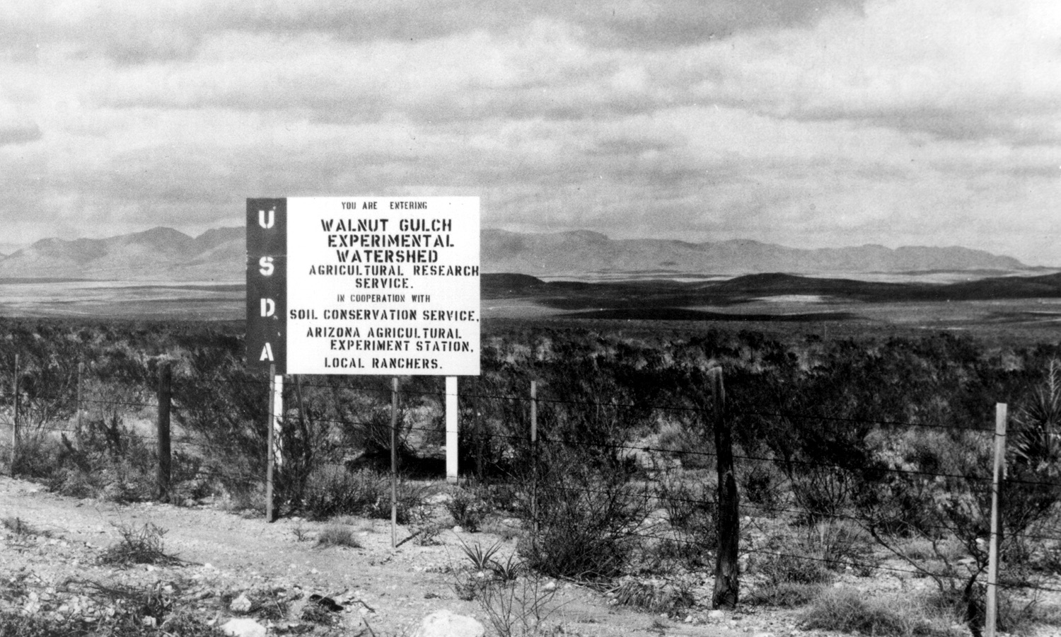 near Tombstone, Arizona, and Alamogordo Creek near Santa Rosa, New Mexico, accelerated instrumentation and data collection. The SWRC also assumed responsibility for the continuing data collection at the experimental watersheds near Albuquerque, New Mexico, and Safford, Arizona. Data collection at these New Mexico and Safford watersheds was discontinued in 1979 because of budget constraints and problems with maintaining the weirs.