|
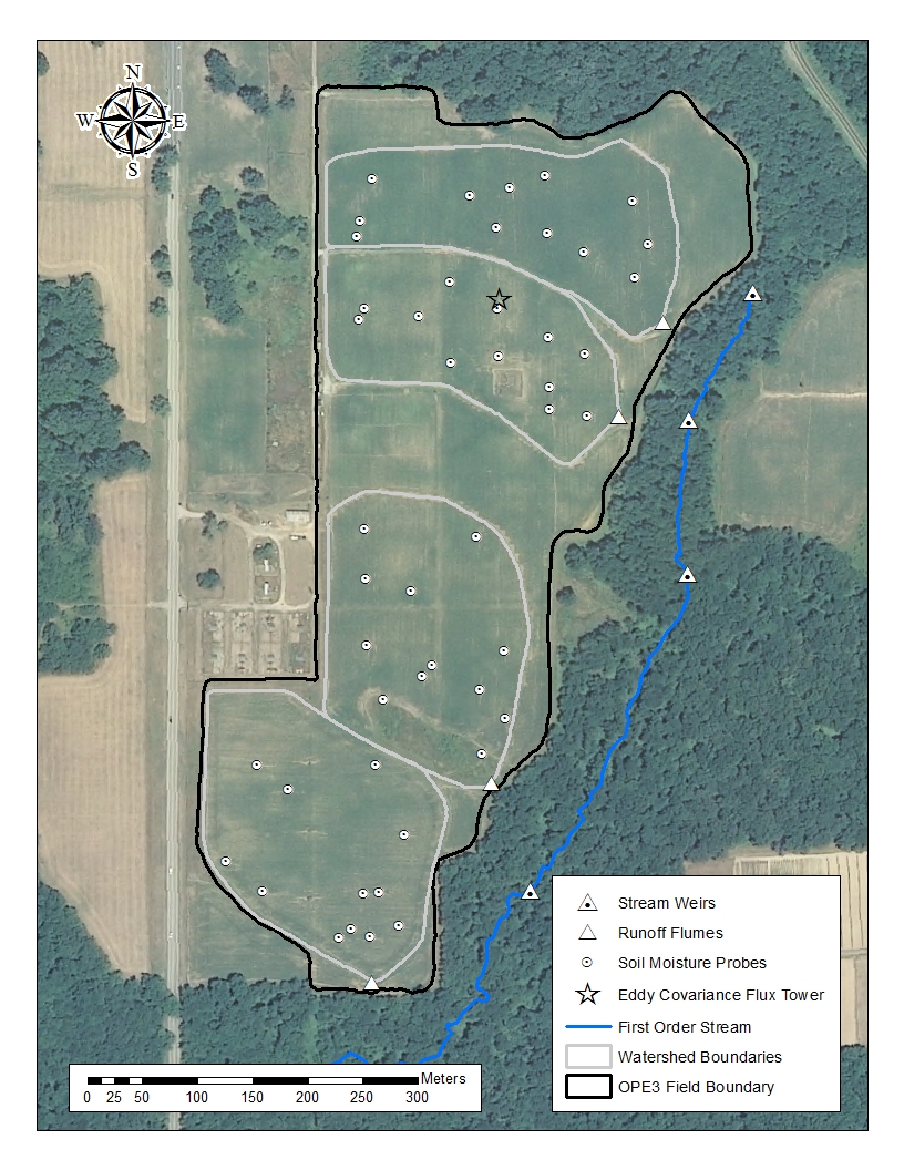
HRSL Research Sites Optimizing Production Inputs for Economic and Environmental Enhancement (OPE3): The Optimizing Production Inputs for Economic and Environmental Enhancement (OPE3) site fosters basic and applied research at the small catchment scale. The site consists of a 22 ha production field, with an adjacent riparian wet-land and 1st order stream. The high density of instrumentation for characterizing water and chemical behavior, as well as several remote sensing platforms allow for detailed monitoring of subsurface, surface and atmospheric processes. Since 1998, over 90 scientists have conducted research at this location from several U.S. Federal agencies, universities (foreign and domestic), and private industry. The infrastructure of OPE3 provides a meaningful evaluation of processes at the field scale, and allows comparison of agricultural production systems because the research site is large enough to capture the spatial variability of crop and soil parameters, yet not so large that the fields themselves are in different climatic or geologic settings. Although some basic research is conducted to better understand processes, much of the research conducted has generated results that have subsequently been utilized at larger watersheds in Iowa and Maryland.
Major Objectives:
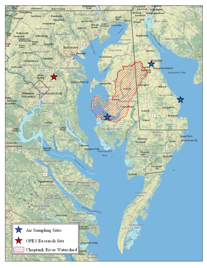
Choptank River Watershed Project: The Choptank River Watershed Project, initiated in 2004, is a long-term project designed to assess the effectiveness of conservation programs at watershed scales and is an ARS Benchmark Watershed as part of the Conservation Effects Assessment Project (CEAP). The Choptank River is located in the Atlantic coastal plain on the eastern shore of the Chesapeake Bay and portions of the watershed been identified as “impaired waters” under Section 303(d) of the Federal Clean Water Act due to high levels of nutrients and sediments. Specific objectives of the project include:
Linkage Across Scales of Observation: Detailed studies of movement and fate of agrochemicals in the riparian buffer at OPE3 demonstrated that naturally occurring preferential flow pathways in riparian wetlands can reduce ecosystem effectiveness for removing agricultural nitrate from exfiltrating groundwater (Angier et al., 2008). They also demonstrated the importance of tree canopy capture of volatilized field-applied pesticides as an important mechanism for delivering pesticides to the stream via canopy wash off. Subsequent work on the Choptank River Watershed provided evidence for importance of this delivery mechanism at larger scales of observation. |